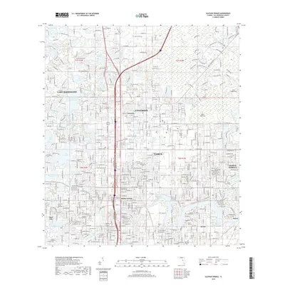
2018 Map of Sulphur Springs
USGS Topo · Published 2018About this map
The Univ of South Florida campus and its surrounding northern Tampa suburbs anchor this detailed 2018 topographic survey. The landscape is defined by its extensive lacustrine network, featuring dozens of named water bodies like Lake Magdalene, Lake Carroll, and the smaller Lamps Pond. These lakes are woven into the residential fabric of communities such as University, Sulphur Springs, and Temple Terrace. The Hillsborough River cuts through the southern portion of the map, passing the Florida College campus and Del Rio.
Find a feature on this map
69 named features on this map. Tap any name to fly to it.
Don’t see what you’re looking for? This feature index may not catch every label — zoom into the map to look around manually.
Map Details
Editions of this 2018 Sulphur Springs Map
This is the sole edition of this map. No revisions or reprints were ever made.
Other maps of this area

1921 · Tampa
USGS Topo · 1:62,500

1921 · St Petersburg
USGS Topo · 1:62,500

1943 · Gandy Bridge
USGS Topo · 1:31,680

1943 · Odessa
USGS Topo · 1:24,000

1943 · Thonotosassa
USGS Topo · 1:24,000

1943 · Lutz
USGS Topo · 1:24,000

1944 · Sulphur Springs
USGS Topo · 1:31,680

1944 · Mango
USGS Topo · 1:31,680

1944 · Tampa
USGS Topo · 1:31,680

1944 · Wesley Chapel
USGS Topo · 1:31,680