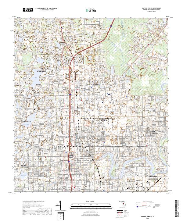
2024 Map of Sulphur Springs
USGS Topo · Published 2024About this map
The Hillsborough River winds through this urbanized landscape, defining the character of North Tampa and its surrounding communities. The area is anchored by the sprawling campus of the University of South Florida and the historic Sulphur Springs neighborhood, while older settlements like Nowatney and Lutz mark the northern periphery. This modern survey illustrates the dense integration of residential developments like Carrollwood and Lake Magdalene around a complex network of sinkhole lakes, including Lake Carroll and Lake Ellen. The map serves as a vital record for family researchers, identifying several local burial sites such as Robles Cem, Ridgewood Cem, and the Branch Family Cem. Further south, the map details the suburban growth of Egypt Lake-Leto and the industrial-residential corridor of East Lake-Orient Park, showing how the modern interstate system has reshaped the traditional layout of these Florida neighborhoods.
Find a feature on this map
63 named features on this map. Tap any name to fly to it.
Don’t see what you’re looking for? This feature index may not catch every label — zoom into the map to look around manually.
Map Details
Editions of this 2024 Sulphur Springs Map
This is the sole edition of this map. No revisions or reprints were ever made.
Other maps of this area

1921 · Tampa
USGS Topo · 1:62,500

1921 · St Petersburg
USGS Topo · 1:62,500

1943 · Gandy Bridge
USGS Topo · 1:31,680

1943 · Odessa
USGS Topo · 1:24,000

1943 · Thonotosassa
USGS Topo · 1:24,000

1943 · Lutz
USGS Topo · 1:24,000

1944 · Sulphur Springs
USGS Topo · 1:31,680

1944 · Mango
USGS Topo · 1:31,680

1944 · Tampa
USGS Topo · 1:31,680

1944 · Wesley Chapel
USGS Topo · 1:31,680