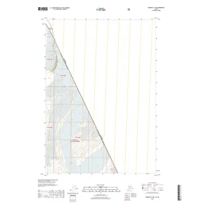
2018 Map of Sumdum C-2 SW
USGS Topo · Published 2018About this map
The Canada-United States border defines the eastern reach of this high-altitude landscape, where the Tongass National Forest meets the international boundary. This area is dominated by massive ice fields and glacial movements, most notably the sprawling Dawes Glacier which carves through the southern portion of the map. The terrain is characterized by sharp elevation changes, anchored by Boundary Peak 75 along the frontier line. Water drainage is largely dictated by the glacial melt, including the headwaters of South Fork Creek. This map captures a remote section of the Hoonah-Angoon Census Area and Petersburg Borough, illustrating the stark interface between protected Alaskan wilderness and the British Columbia interior before modern climate shifts further altered the glacial extent.
Find a feature on this map
10 named features on this map. Tap any name to fly to it.
Don’t see what you’re looking for? This feature index may not catch every label — zoom into the map to look around manually.
Map Details
Editions of this 2018 Sumdum C-2 SW Map
This is the sole edition of this map. No revisions or reprints were ever made.
Other maps of this area

1952 · Sumdum
USGS Topo · 1:250,000

1961 · Sumdum C-3
USGS Topo · 1:63,360

1961 · Sumdum B-2
USGS Topo · 1:63,360
1961 · Sumdum C-2
USGS Topo · 1:63,360

1961 · Sumdum B-3
USGS Topo · 1:63,360

1961 · Sumdum
USGS Topo · 1:250,000

1996 · Sumdum B-3
USGS Topo · 1:63,360

2000 · Sumdum C-3
USGS Topo · 1:63,360

2000 · Sumdum B-2
USGS Topo · 1:63,360
2018 · Sumdum C-3 NE
USGS Topo · 1:25,000