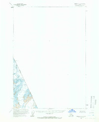
1961 Map of Sumdum C-2
USGS Topo · Published 1966About this map
Boundary Peak 75 marks the rugged international divide in this sparsely labeled 1961 survey, where the high-altitude terrain is defined by the United States-Canada border. The map provides a focused look at the glaciated topography of Southeast Alaska, characterized by steep contour lines and expansive ice fields. Notably, the presence of Crevasses indicates active glacial movement and hazardous terrain at the time of the aerial photography. Because this section follows the narrow corridor of the boundary, most of the quadrangle remains blank, emphasizing the isolated nature of these peaks and the precision required by the International Boundary Commission and the U.S. Geological Survey to define this remote frontier.
Find a feature on this map
3 named features on this map. Tap any name to fly to it.
Don’t see what you’re looking for? This feature index may not catch every label — zoom into the map to look around manually.
Map Details
Editions of this 1961 Sumdum C-2 Map
2 editions found
Other maps of this area

1952 · Sumdum
USGS Topo · 1:250,000

1961 · Sumdum D-3
USGS Topo · 1:63,360

1961 · Sumdum C-3
USGS Topo · 1:63,360

1961 · Sumdum B-2
USGS Topo · 1:63,360

1961 · Sumdum B-3
USGS Topo · 1:63,360

1961 · Sumdum
USGS Topo · 1:250,000

1996 · Sumdum B-3
USGS Topo · 1:63,360

2000 · Sumdum C-3
USGS Topo · 1:63,360

2000 · Sumdum B-2
USGS Topo · 1:63,360
2018 · Sumdum C-3 NE
USGS Topo · 1:25,000