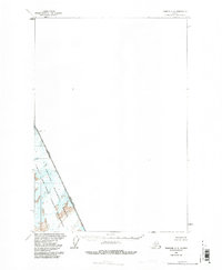
1961 Map of Sumdum C-2
USGS Topo · Published 1985About this map
Boundary Peak 75 7776 stands as a primary survey marker on the international boundary between Alaska and British Columbia during the early 1960s. This survey, conducted by the Geological Survey and the International Boundary Commission, documents the remote coastal topography where the United States and Canada meet. The landscape is dominated by the steep fjord systems of Tracy Arm and Fords Terror, situated within the sprawling Tongass National Forest. The map illustrates the glacial character of the region, specifically focusing on the protected lands of the Fords Terror Wilderness. This 1961 record provides an essential view of the untouched maritime wilderness before later administrative revisions, capturing the precise line where coastal Alaska transitions into the high peaks of British Columbia.
Find a feature on this map
7 named features on this map. Tap any name to fly to it.
Don’t see what you’re looking for? This feature index may not catch every label — zoom into the map to look around manually.
Map Details
Editions of this 1961 Sumdum C-2 Map
2 editions found
Other maps of this area

1952 · Sumdum
USGS Topo · 1:250,000

1961 · Sumdum D-3
USGS Topo · 1:63,360

1961 · Sumdum C-3
USGS Topo · 1:63,360

1961 · Sumdum B-2
USGS Topo · 1:63,360
1961 · Sumdum C-2
USGS Topo · 1:63,360

1961 · Sumdum B-3
USGS Topo · 1:63,360

1961 · Sumdum
USGS Topo · 1:250,000

1996 · Sumdum B-3
USGS Topo · 1:63,360

2000 · Sumdum C-3
USGS Topo · 1:63,360

2000 · Sumdum B-2
USGS Topo · 1:63,360