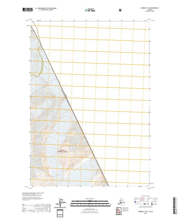
2021 Map of Sumdum C-2 SW
USGS Topo · Published 2021About this map
Boundary Peak 73 stands as a primary survey marker on the international divide where the United States and Canada border cuts through the southeastern Alaska wilderness. This high-altitude landscape is characterized by its dramatic glacial activity and the rugged terrain of the Tongass National Forest. The map delineates the administrative intersection of the Hoonah-Angoon Census Area and the Petersburg Borough, showing how these modern boundaries follow the natural crests of the mountains. To the north, the massive ice flow of Sawyer Glacier dominates the drainage, illustrating the persistent ice fields that define the interior of the Sumdum region. The lack of roads or established settlements emphasizes the wilderness character of the T49S and T50S townships along this high-latitude frontier.
Find a feature on this map
9 named features on this map. Tap any name to fly to it.
Don’t see what you’re looking for? This feature index may not catch every label — zoom into the map to look around manually.
Map Details
Editions of this 2021 Sumdum C-2 SW Map
This is the sole edition of this map. No revisions or reprints were ever made.
Other maps of this area

1952 · Sumdum
USGS Topo · 1:250,000

1961 · Sumdum C-3
USGS Topo · 1:63,360

1961 · Sumdum B-2
USGS Topo · 1:63,360
1961 · Sumdum C-2
USGS Topo · 1:63,360

1961 · Sumdum B-3
USGS Topo · 1:63,360

1961 · Sumdum
USGS Topo · 1:250,000

1996 · Sumdum B-3
USGS Topo · 1:63,360

2000 · Sumdum C-3
USGS Topo · 1:63,360

2000 · Sumdum B-2
USGS Topo · 1:63,360
2018 · Sumdum C-3 NE
USGS Topo · 1:25,000