
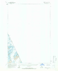
2000 Map of Sumdum C-3
USGS Topo · Published 2003About this map
Glacial ice and deep fjords dominate this remote reach of the Tongass National Forest along the international border. The landscape is defined by massive ice flows, including the South Sawyer Glacier and the Brown Glacier, which feed into the iconic waters of Tracy Arm. To the south, Dawes Glacier terminates at the head of Endicott Arm, illustrating the dramatic coastal topography of Southeast Alaska. Much of this terrain is preserved within the Tracy Arm - Fords Terror Wilderness, a region where high peaks like Boundary Peak 76 and Stump 6605 mark the rugged divide between the United States and British Columbia, Canada. This survey reflects the state of these tidewater glaciers at the close of the twentieth century, providing a detailed record of the ice margins and elevation contours prior to more recent shifts in the glacial environment.
Find a feature on this map
12 named features on this map. Tap any name to fly to it.
Don’t see what you’re looking for? This feature index may not catch every label — zoom into the map to look around manually.
Map Details
Editions of this 2000 Sumdum C-3 Map
This is the sole edition of this map. No revisions or reprints were ever made.
Other maps of this area

1943 · Sumdum B-4
USGS Topo · 1:63,360

1948 · Sumdum B-4
USGS Topo · 1:63,360

1952 · Sumdum
USGS Topo · 1:250,000

1960 · Sumdum D-4
USGS Topo · 1:63,360

1961 · Sumdum D-3
USGS Topo · 1:63,360

1961 · Sumdum C-3
USGS Topo · 1:63,360

1961 · Sumdum B-2
USGS Topo · 1:63,360

1961 · Sumdum C-4
USGS Topo · 1:63,360
1961 · Sumdum C-2
USGS Topo · 1:63,360

1961 · Sumdum B-3
USGS Topo · 1:63,360