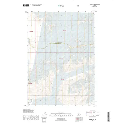
2018 Map of Sumdum C-3 SE
USGS Topo · Published 2018About this map
South Sawyer Glacier and the Sawyer Glacier dominate this high-latitude terrain within the Tongass National Forest. Located along the border of the Hoonah - Angoon Census Area and Petersburg Borough, the landscape is defined by the massive ice fields of the Coast Mountains. This 2018 survey illustrates the modern extent of these glacial systems, providing a precise record of ice coverage and topographic contours at the height of the 21st century. The map serves as a vital point of comparison for those studying the movement of Alaskan glaciers and the evolving boundary between ice and the surrounding forest lands.
Find a feature on this map
9 named features on this map. Tap any name to fly to it.
Don’t see what you’re looking for? This feature index may not catch every label — zoom into the map to look around manually.
Map Details
Editions of this 2018 Sumdum C-3 SE Map
This is the sole edition of this map. No revisions or reprints were ever made.
Other maps of this area

1952 · Sumdum
USGS Topo · 1:250,000

1961 · Sumdum C-3
USGS Topo · 1:63,360

1961 · Sumdum B-2
USGS Topo · 1:63,360
1961 · Sumdum C-2
USGS Topo · 1:63,360

1961 · Sumdum B-3
USGS Topo · 1:63,360

1961 · Sumdum
USGS Topo · 1:250,000

1996 · Sumdum B-3
USGS Topo · 1:63,360

2000 · Sumdum C-3
USGS Topo · 1:63,360

2000 · Sumdum B-2
USGS Topo · 1:63,360
2018 · Sumdum C-3 NE
USGS Topo · 1:25,000