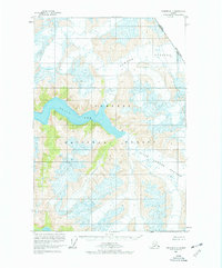
1960 Map of Sumdum D-4
USGS Topo · Published 1977About this map
Sawyer Glacier and South Sawyer Glacier dominate this glacial landscape along the international border between Alaska and British Columbia. Located within the Tongass National Forest, the map illustrates a terrain defined by ice and water, where massive ice fields meet the fjord of Tracy Arm. The 1960 field annotation captures a specific moment in the glaciological history of the region, documenting numerous crevasses and the intricate drainage patterns of the coastal mountains. The boundary line between the United States and Canada is clearly delineated as it traverses these high-altitude ice fields, providing a critical reference for researchers studying territorial borders and wilderness preservation in the mid-20th century.
Find a feature on this map
7 named features on this map. Tap any name to fly to it.
Don’t see what you’re looking for? This feature index may not catch every label — zoom into the map to look around manually.
Map Details
Editions of this 1960 Sumdum D-4 Map
4 editions found
Other maps of this area

1948 · Sumdum C-5
USGS Topo · 1:63,360

1948 · Sumdum D-5
USGS Topo · 1:63,360

1951 · Taku River A-4
USGS Topo · 1:63,360

1951 · Taku River A-5
USGS Topo · 1:63,360

1951 · Sumdum C-5
USGS Topo · 1:63,360

1952 · Sumdum
USGS Topo · 1:250,000

1953 · Taku River
USGS Topo · 1:250,000

1955 · Sumdum D-5
USGS Topo · 1:63,360

1960 · Taku River
USGS Topo · 1:250,000

1960 · Sumdum D-4
USGS Topo · 1:63,360