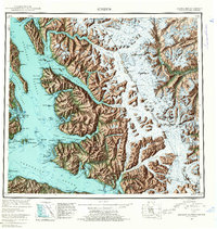
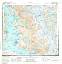
1952 Map of Sumdum
USGS Topo · Published 1961About this map
Deep fjords and advancing ice fields dominate this portion of the Alaska-Canada borderlands, where the coastal wilderness meets the high peaks of British Columbia. Small outposts like Sumdum and Windham mark the human presence in a landscape shaped by massive glacial systems, including the Sawyer Glacier and Dawes Glacier. These settlements, along with the Chuck Mining Camp and Indian Village, highlight the era's reliance on maritime access through Stephens Passage and Endicott Arm. The map records a complex network of international markers along the summit ridges, from Boundary Peak 78 to Boundary Peak 70, delineating the remote boundary between Alaska and Canada. Waterways like Tracy Arm and Fords Terror suggest the formidable maritime navigation required to reach these isolated mining and fishing sites during the early 1950s.
Find a feature on this map
148 named features on this map. Tap any name to fly to it.
Don’t see what you’re looking for? This feature index may not catch every label — zoom into the map to look around manually.
Map Details
Editions of this 1952 Sumdum Map
6 editions found

Other maps of this area

1943 · Sumdum B-4
USGS Topo · 1:63,360

1948 · Sitka D-1
USGS Topo · 1:63,360

1948 · Sitka B-1
USGS Topo · 1:63,360

1948 · Sumdum A-4
USGS Topo · 1:63,360

1948 · Sitka C-1
USGS Topo · 1:63,360

1948 · Sumdum D-6
USGS Topo · 1:63,360

1948 · Sumdum A-5
USGS Topo · 1:63,360

1948 · Sumdum C-5
USGS Topo · 1:63,360

1948 · Sumdum A-6
USGS Topo · 1:63,360

1948 · Sumdum B-6
USGS Topo · 1:63,360