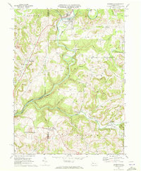
1969 Map of Summerville
USGS Topo · Published 1972About this map
Red Bank Creek defines the northern reaches of this territory, where the Penn Central railroad follows the winding river valley through Summerville. In the late 1960s, this landscape in Jefferson and Clarion counties was heavily defined by an energy economy, evidenced by the high concentration of Gas Wells and significant Strip Mines appearing near Conifer. The map reveals a tight-knit network of rural communities and crossroads, including Worthville and Shannondale, often centered around institutions like Mt Pleasant Ch and the Content school. Beyond the industrial sites, the terrain is deeply dissected by numerous waterways such as Little Sandy Creek and Cherry Run, which dictated the placement of early settlements and family cemeteries like the Carrier Cem and Vandervort Cem.
Find a feature on this map
54 named features on this map. Tap any name to fly to it.
Don’t see what you’re looking for? This feature index may not catch every label — zoom into the map to look around manually.
Map Details
Editions of this 1969 Summerville Map
3 editions found
Other maps of this area

1901 · Rural Valley
USGS Topo · 1:62,500

1903 · Rural Valley
USGS Topo · 1:62,500

1906 · Clarion
USGS Topo · 1:62,500

1907 · Clarion
USGS Topo · 1:62,500

1909 · Smicksburg
USGS Topo · 1:62,500

1924 · Brookville
USGS Topo · 1:62,500

1926 · Brookville
USGS Topo · 1:62,500

1938 · Smicksburg
USGS Topo · 1:62,500

1939 · Smicksburg
USGS Topo · 1:62,500

1944 · Brookville
USGS Topo · 1:62,500