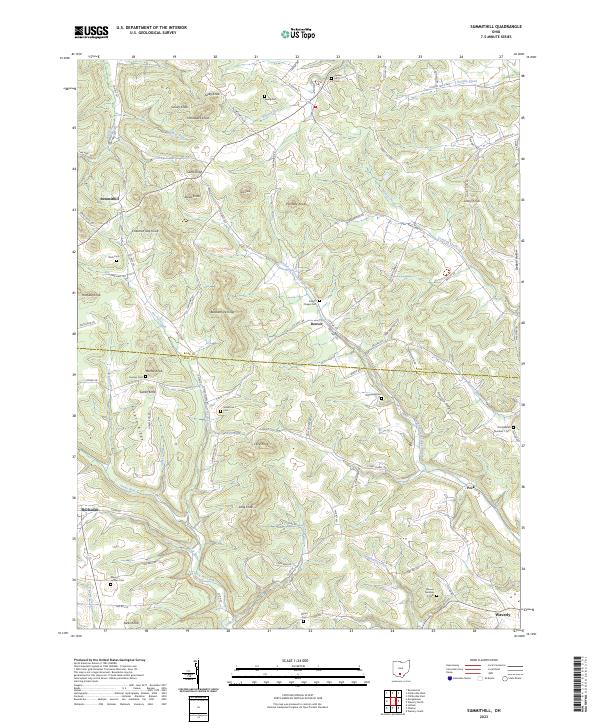
2023 Map of Summithill
USGS Topo · Published 2023About this map
The border between Ross and Pike Counties in southern Ohio defines this landscape of prominent peaks and deep hollows. The terrain is characterized by a series of distinct knobs, including Pinnacle Knob, Blackamore Knob, and Gantz Knob, which rise above winding waterways like Pee Pee Creek and Crooked Creek. These features suggest a topography that heavily influenced early settlement patterns and the winding paths of rural routes like Camelin Hill Rd and Clines Chapel Rd.
Find a feature on this map
97 named features on this map. Tap any name to fly to it.
Don’t see what you’re looking for? This feature index may not catch every label — zoom into the map to look around manually.
Map Details
Editions of this 2023 Summithill Map
This is the sole edition of this map. No revisions or reprints were ever made.
Other maps of this area

1906 · Waverly
USGS Topo · 1:62,500

1906 · Chillicothe
USGS Topo · 1:62,500

1908 · Chillicothe
USGS Topo · 1:62,500

1908 · Waverly
USGS Topo · 1:62,500

1912 · Roxabell
USGS Topo · 1:62,500

1914 · Roxabell
USGS Topo · 1:62,500

1915 · Piketon
USGS Topo · 1:62,500

1917 · Piketon
USGS Topo · 1:62,500

1944 · Piketon
USGS Topo · 1:62,500

1944 · Roxabell
USGS Topo · 1:62,500