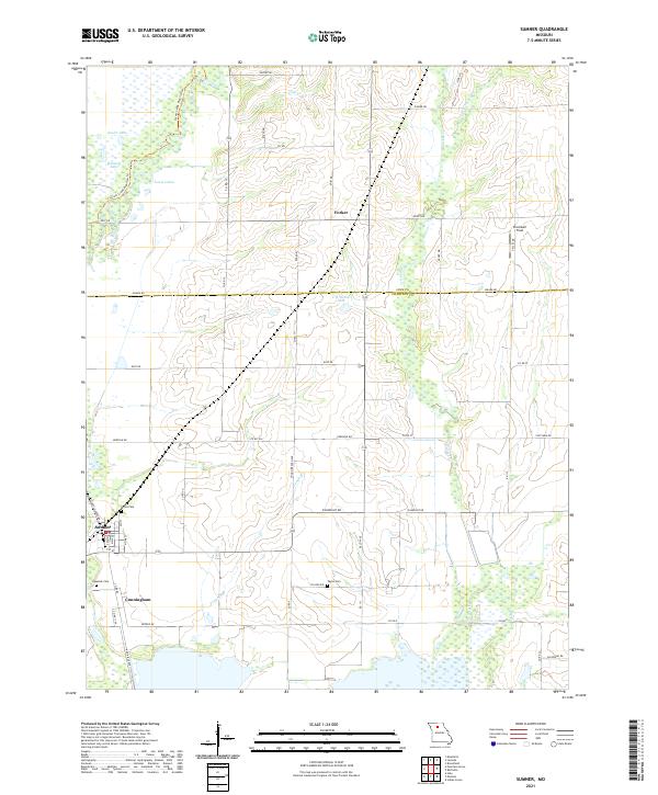
2021 Map of Sumner
USGS Topo · Published 2021About this map
Sumner anchors this landscape in western Chariton County, situated along the complex drainage network of the Grand River basin. The area is defined by its extensive wetlands and managed water bodies, including Boiler Lake, Ransom Lake, and Lewis Lakes to the north. This 2021 survey reveals a region deeply tied to its hydrological character, where the Linn County and Chariton County line intersects rural reaches punctuated by the small settlements of Forker and Cunningham.
Find a feature on this map
56 named features on this map. Tap any name to fly to it.
Don’t see what you’re looking for? This feature index may not catch every label — zoom into the map to look around manually.
Map Details
Editions of this 2021 Sumner Map
This is the sole edition of this map. No revisions or reprints were ever made.
Other maps of this area

1924 · Chula
USGS Topo · 1:62,500

1924 · Hale
USGS Topo · 1:62,500

1946 · Brookfield
USGS Topo · 1:62,500

1947 · Chula
USGS Topo · 1:62,500

1948 · Brookfield
USGS Topo · 1:62,500

1949 · Mendon
USGS Topo · 1:24,000

1949 · Indian Grove
USGS Topo · 1:24,000

1949 · Sumner
USGS Topo · 1:24,000

1949 · Rothville
USGS Topo · 1:24,000

1950 · Sumner
USGS Topo · 1:24,000