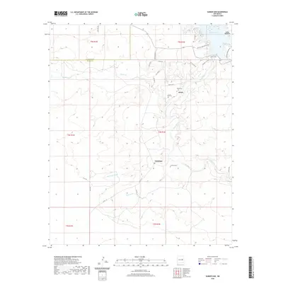
2020 Map of Sumner Dam
USGS Topo · Published 2020About this map
Sumner Dam controls the flow of the Pecos River at the northern edge of this New Mexico landscape, creating the expansive Lake Sumner. The surrounding terrain is defined by dry watercourses such as Guadalupe Arroyo, Tigre Arroyo, and Salado Cr, which feed into the river valley. This 2020 survey reveals a sparse settlement pattern centered around the small communities of Guadalupe and Salado, situated near the riverbanks.
Find a feature on this map
34 named features on this map. Tap any name to fly to it.
Don’t see what you’re looking for? This feature index may not catch every label — zoom into the map to look around manually.
Map Details
Editions of this 2020 Sumner Dam Map
This is the sole edition of this map. No revisions or reprints were ever made.
Other maps of this area

1954 · Fort Sumner
USGS Topo · 1:250,000

1958 · Fort Sumner
USGS Topo · 1:250,000

1965 · Fort Sumner West
USGS Topo · 1:24,000

1965 · Windmill Draw
USGS Topo · 1:24,000

1966 · Gibbons Ranch
USGS Topo · 1:24,000

1966 · Ricardo
USGS Topo · 1:24,000

1966 · Ojo Negro Creek
USGS Topo · 1:24,000

1966 · Alamogordo Dam
USGS Topo · 1:24,000

1966 · Cooper Ranch
USGS Topo · 1:24,000

1966 · Colorado Canyon
USGS Topo · 1:24,000