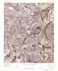
1974 Map of Sumner NW
USGS Topo · Published 1975About this map
Quiver River meanders in tight, dramatic oxbows across this Mississippi Delta landscape, defining a terrain of intense agricultural geometry. This 1974 orthophotoquad captures the stark contrast between the winding natural watercourse and the rigid grid of modern plantation-scale farming. In the western portion of the sheet, the small settlement of Rome sits along the rail line, while further south lies the community of Parchman. The aerial perspective reveals how the alluvial plain has been thoroughly organized into large, rectangular fields, with only thin ribbons of timber remaining along the banks of the river's loops and cutoffs. This document provides a clear look at land-use patterns in Tallahatchie County during the mid-1970s, showing the intersection of rural life and industrialized cotton and soybean production.
Find a feature on this map
3 named features on this map. Tap any name to fly to it.
Don’t see what you’re looking for? This feature index may not catch every label — zoom into the map to look around manually.
Map Details
Editions of this 1974 Sumner NW Map
2 editions found
Other maps of this area

1931 · Sumner
USGS Topo · 1:48,000

1931 · Drew
USGS Topo · 1:48,000

1932 · Tutwiler
USGS Topo · 1:48,000

1935 · Clarksdale
USGS Topo · 1:62,500

1935 · Sumner
USGS Topo · 1:62,500

1935 · Tutwiler
USGS Topo · 1:62,500

1935 · Mound Bayou
USGS Topo · 1:62,500

1939 · Sumner
USGS Topo · 1:62,500

1939 · Tutwiler
USGS Topo · 1:62,500

1939 · Clarksdale
USGS Topo · 1:62,500