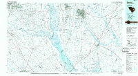
1986 Map of Sumter
USGS Topo · Published 1986About this map
Congaree Swamp National Monument and the expansive Manchester State Forest dominate the central landscape of this mid-1980s survey, marking a region defined by its dense river bottomlands and managed timberlands. The confluence of the Wateree River and Congaree River forms the Santee River, flowing into the headwaters of Lake Marion. This hydrology shaped the settlement patterns of towns like Fort Motte, Rimini, and Pinewood.
Find a feature on this map
244 named features on this map. Tap any name to fly to it.
Don’t see what you’re looking for? This feature index may not catch every label — zoom into the map to look around manually.
Map Details
Editions of this 1986 Sumter Map
This is the sole edition of this map. No revisions or reprints were ever made.
Other maps of this area

1904 · Columbia
USGS Topo · 1:125,000

1919 · Bamberg
USGS Topo · 1:48,000

1920 · Eutawville
USGS Topo · 1:48,000

1920 · Chicora
USGS Topo · 1:48,000

1920 · Bowman
USGS Topo · 1:48,000

1920 · Mayesville
USGS Topo · 1:48,000

1920 · Manning
USGS Topo · 1:48,000

1920 · Bamberg
USGS Topo · 1:62,500

1920 · Orangeburg
USGS Topo · 1:48,000

1921 · Orangeburg
USGS Topo · 1:62,500