
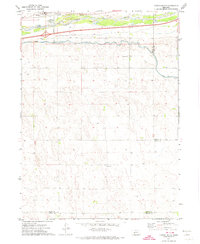
1971 Map of Sutherland Reservoir West
USGS Topo · Published 1974About this map
Sutherland Reservoir dominates the northeastern landscape of this Lincoln County survey, showcasing the essential water management infrastructure of western Nebraska in the early 1970s. The artificial lake is held by a prominent Levee and serves as a focal point for both utility and recreation, adjacent to the Sutherland Reservoir State Park. Flowing westward from the reservoir, the Sutherland Canal cuts across the center of the sheet, providing a vital artery for irrigation and power. The map details the technical operations of the era, including a Gaging Station and multiple communication points like the Radio Tower (ETV). Outside the developed reservoir area, the terrain is defined by numerous Wells and the county boundary between Keith Co and Lincoln Co, reflecting a rural landscape shaped by agricultural necessity and the Tri-County Project's hydrological legacy.
Find a feature on this map
11 named features on this map. Tap any name to fly to it.
Don’t see what you’re looking for? This feature index may not catch every label — zoom into the map to look around manually.
Map Details
Editions of this 1971 Sutherland Reservoir West Map
This is the sole edition of this map. No revisions or reprints were ever made.
Other maps of this area

1898 · Paxton
USGS Topo · 1:125,000

1901 · Paxton
USGS Topo · 1:125,000

1954 · McCook
USGS Topo · 1:250,000

1954 · North Platte
USGS Topo · 1:250,000

1956 · North Platte
USGS Topo · 1:250,000

1957 · North Platte
USGS Topo · 1:250,000

1957 · McCook
USGS Topo · 1:250,000

1958 · McCook
USGS Topo · 1:250,000

1967 · North Platte
USGS Topo · 1:250,000
1971 · Paxton South
USGS Topo · 1:24,000