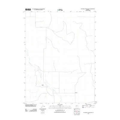
2011 Map of Suttlers Canyon East
USGS Topo · Published 2011About this map
Marengo occupies the lower elevations of this Hayes County landscape, situated near the winding path of Red Willow Creek. The geography is defined by the significant incision of Suttlers Canyon, which cuts through the high plains of Southwest Nebraska. This 2011 survey reflects a sparsely populated ranching and agricultural region where the grid of rural transit is maintained by routes such as S Dickens Rd, W Ingham Rd, and S Trinity Rd. The map illustrates the fundamental relationship between water access and settlement in the High Plains, where the drainage of the creek dictates the local topography and the positioning of the community at Marengo.
Find a feature on this map
6 named features on this map. Tap any name to fly to it.
Don’t see what you’re looking for? This feature index may not catch every label — zoom into the map to look around manually.
Map Details
Editions of this 2011 Suttlers Canyon East Map
This is the sole edition of this map. No revisions or reprints were ever made.
Other maps of this area

1954 · McCook
USGS Topo · 1:250,000

1956 · White NE
USGS Topo · 1:24,000

1956 · Dickens
USGS Topo · 1:24,000

1956 · Somerset
USGS Topo · 1:24,000

1957 · McCook
USGS Topo · 1:250,000

1958 · McCook
USGS Topo · 1:250,000

1973 · Camp Hayes Lake SE
USGS Topo · 1:24,000

1973 · Suttlers Canyon East
USGS Topo · 1:24,000

1973 · Suttlers Canyon West
USGS Topo · 1:24,000
1973 · Melton Ranch Airport
USGS Topo · 1:24,000