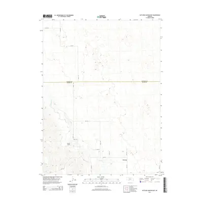
2014 Map of Suttlers Canyon East
USGS Topo · Published 2014About this map
Marengo sits in the southeastern corner of this landscape, positioned where the High Plains terrain begins its descent toward the drainage of Red Willow Cr. The area is defined by the county line dividing Lincoln Co and Hayes Co, a boundary that bisects the map horizontally. In the southwestern quadrant, the namesake Suttlers Canyon provides a significant topographic break, with several tributary drainages feeding into the creek system. The map reflects a modern rural infrastructure of section-line roads and avenues, such as Trinity Rd and Ingham Rd, which facilitate movement across the cattle country of western Nebraska. The sparse distribution of named settlements emphasizes the low-density ranching character of the region during the early twenty-first century.
Find a feature on this map
20 named features on this map. Tap any name to fly to it.
Don’t see what you’re looking for? This feature index may not catch every label — zoom into the map to look around manually.
Map Details
Editions of this 2014 Suttlers Canyon East Map
This is the sole edition of this map. No revisions or reprints were ever made.
Other maps of this area

1954 · McCook
USGS Topo · 1:250,000

1956 · White NE
USGS Topo · 1:24,000

1956 · Dickens
USGS Topo · 1:24,000

1956 · Somerset
USGS Topo · 1:24,000

1957 · McCook
USGS Topo · 1:250,000

1958 · McCook
USGS Topo · 1:250,000

1973 · Camp Hayes Lake SE
USGS Topo · 1:24,000

1973 · Suttlers Canyon East
USGS Topo · 1:24,000

1973 · Suttlers Canyon West
USGS Topo · 1:24,000
1973 · Melton Ranch Airport
USGS Topo · 1:24,000