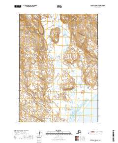
2019 Map of Sutwik Island D-4 NE
USGS Topo · Published 2019About this map
The Aleutian Range dominates this portion of the Alaska Peninsula, where steep mountain terrain meets the coastal reaches of the Pacific Ocean. This survey reveals a landscape shaped by glacial and volcanic activity, primarily characterized by high-elevation contours and the drainage of Home Cr toward the south. The absence of roads or permanent settlements underscores the isolation of the area within the Lake and Peninsula Borough. Historically, these shorelines were integral to the maritime activities of the region, though on this 2019 sheet, the land remains largely untouched by modern infrastructure. Researchers will find the Public Land Survey System grids, such as T37s R50w and T38s R49w, providing a structured overlay to this formidable coastal wilderness.
Find a feature on this map
8 named features on this map. Tap any name to fly to it.
Don’t see what you’re looking for? This feature index may not catch every label — zoom into the map to look around manually.
Map Details
Editions of this 2019 Sutwik Island D-4 NE Map
This is the sole edition of this map. No revisions or reprints were ever made.
Other maps of this area

1943 · Ugashik
USGS Topo · 1:250,000

1948 · Ugashik
USGS Topo · 1:250,000

1949 · Ugashik
USGS Topo · 1:250,000

1951 · Sutwik Island
USGS Topo · 1:250,000

1954 · Ugashik A-3
USGS Topo · 1:63,360

1954 · Sutwik Island D-3
USGS Topo · 1:63,360

1963 · Ugashik A-4
USGS Topo · 1:63,360

1963 · Sutwik Island
USGS Topo · 1:250,000
1963 · Sutwik Island D-4
USGS Topo · 1:63,360

1963 · Ugashik
USGS Topo · 1:250,000