
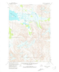
1963 Map of Ugashik A-4
USGS Topo · Published 1967About this map
Mother Goose Lake dominates the northwest corner of this Alaska Peninsula landscape, its waters fed by a complex drainage network that includes the braided channels of Volcano Creek. The terrain is defined by dramatic topographic relief, where steep ridges rise sharply above low-lying wetlands and alluvial flats. The mapping, based on 1962 aerial photography, documents the natural hydrology before any modern development or roads reached this part of the Seward Meridian. Smaller water bodies like Needle Lake are tucked into the base of high ridges, while the aptly named Indecision Creek meanders through the central lowlands, illustrating the shifting, unstable nature of glacial and volcanic runoff patterns in this remote coastal region.
Find a feature on this map
4 named features on this map. Tap any name to fly to it.
Don’t see what you’re looking for? This feature index may not catch every label — zoom into the map to look around manually.
Map Details
Editions of this 1963 Ugashik A-4 Map
2 editions found
Other maps of this area

1943 · Ugashik
USGS Topo · 1:250,000

1948 · Ugashik
USGS Topo · 1:250,000

1949 · Ugashik
USGS Topo · 1:250,000

1951 · Sutwik Island
USGS Topo · 1:250,000

1951 · Ugashik B-3
USGS Topo · 1:63,360

1954 · Ugashik A-3
USGS Topo · 1:63,360

1954 · Sutwik Island D-3
USGS Topo · 1:63,360

1954 · Ugashik B-4
USGS Topo · 1:63,360

1954 · Ugashik B-5
USGS Topo · 1:63,360

1963 · Sutwik Island
USGS Topo · 1:250,000