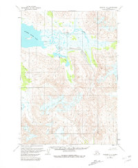
1963 Map of Ugashik A-4
USGS Topo · Published 1981About this map
Mother Goose Lake dominates the northwest corner of this 1963 Alaskan landscape, serving as a primary hydrologic anchor in a region defined by its complex drainage systems. The survey, based on 1962 aerial photography and 1963 field annotations, traces the meandering paths of Volcano Creek and the aptly named Indecision Creek, which weave through the terrain before reaching the larger water bodies. To the south, Needle Lake is situated amidst a network of elevation contours that illustrate the isolation of this interior territory. This document, revised in 1981 by the U.S. Geological Survey, reflects the mapping of unsurveyed and unmarked land lines as interpreted by the Bureau of Land Management. The presence of Painter Cr on the western edge highlights the intricate network of tributaries that characterize the Ugashik region during this era of early-sixties topographic exploration.
Find a feature on this map
5 named features on this map. Tap any name to fly to it.
Don’t see what you’re looking for? This feature index may not catch every label — zoom into the map to look around manually.
Map Details
Editions of this 1963 Ugashik A-4 Map
2 editions found
Other maps of this area

1943 · Ugashik
USGS Topo · 1:250,000

1948 · Ugashik
USGS Topo · 1:250,000

1949 · Ugashik
USGS Topo · 1:250,000

1951 · Sutwik Island
USGS Topo · 1:250,000

1951 · Ugashik B-3
USGS Topo · 1:63,360

1954 · Ugashik A-3
USGS Topo · 1:63,360

1954 · Sutwik Island D-3
USGS Topo · 1:63,360

1954 · Ugashik B-4
USGS Topo · 1:63,360

1954 · Ugashik B-5
USGS Topo · 1:63,360

1963 · Ugashik A-4
USGS Topo · 1:63,360