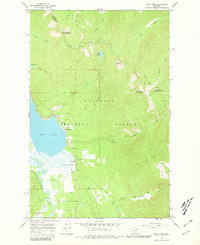
1965 Map of Swan Lake
USGS Topo · Published 1981About this map
Swan Lake and the winding Swan River dominate the lowlands of this mid-1960s survey, representing a critical northern Montana corridor within the Flathead National Forest. The small settlement of Swan Lake serves as a focal point near the northern shore, supported by the Swan Lake Guard Station and a nearby campground. The landscape is defined by its transit and surveillance infrastructure, from the Landing Strip tucked into the valley to the Mission Lookout and high-altitude lookout on Sixmile Mountain. Higher elevations are navigated by a network of historic routes including the Alpine Trail, Pack Trail, and Wire Trail, which connect peaks such as Con Kelley Mountain and Hall Peak. To the east, the isolation of Shelter Cabin and remote waters like Hall Lake illustrate the backcountry nature of the Flathead and Lake County boundary region before modern development intensified.
Find a feature on this map
31 named features on this map. Tap any name to fly to it.
Don’t see what you’re looking for? This feature index may not catch every label — zoom into the map to look around manually.
Map Details
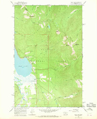
Editions of this 1965 Swan Lake Map
2 editions found
Other maps of this area

1914 · Nyack
USGS Topo · 1:125,000

1955 · Choteau
USGS Topo · 1:250,000

1957 · Choteau
USGS Topo · 1:250,000

1958 · Choteau
USGS Topo · 1:250,000

1958 · Quintonkon
USGS Topo · 1:24,000

1960 · Cut Bank
USGS Topo · 1:250,000

1962 · Choteau
USGS Topo · 1:250,000

1963 · Cut Bank
USGS Topo · 1:250,000

1964 · Cut Bank
USGS Topo · 1:250,000
1964 · Crater Lake
USGS Topo · 1:24,000