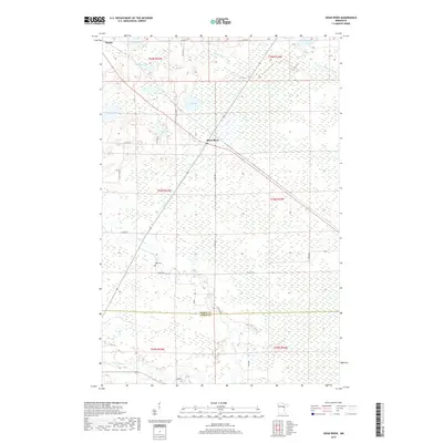
2019 Map of Swan River
USGS Topo · Published 2019About this map
Swan River and the small settlement of Warba define the settled landscape of this northern Minnesota region. The terrain is characterized by a dense network of wetlands and small water bodies, including Bog Lake, Culp Lake, and Bullhead Lake. This 2019 survey illustrates the low-lying geography where Bruce Cr and the W Br Floodwood River meander through the townships. For genealogists and local historians, the presence of Sago Cem near the banks of the river provides a specific point of interest for family research. The map also delineates the boundary between Itasca Co and Aitkin Co, showing how contemporary county lines intersect with historical township divisions such as t54n r23w and t53n r23w.
Find a feature on this map
34 named features on this map. Tap any name to fly to it.
Don’t see what you’re looking for? This feature index may not catch every label — zoom into the map to look around manually.
Map Details
Editions of this 2019 Swan River Map
This is the sole edition of this map. No revisions or reprints were ever made.
Other maps of this area

1953 · Duluth
USGS Topo · 1:250,000

1954 · Hibbing
USGS Topo · 1:250,000

1957 · Hibbing
USGS Topo · 1:250,000

1958 · Hibbing
USGS Topo · 1:250,000

1958 · Duluth
USGS Topo · 1:250,000

1964 · Hibbing
USGS Topo · 1:250,000

1969 · Wawina
USGS Topo · 1:24,000
1969 · Floodwood Lake
USGS Topo · 1:24,000
1969 · Goodland
USGS Topo · 1:24,000

1969 · Island
USGS Topo · 1:24,000