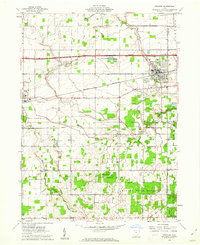
1960 Map of Swanton
USGS Topo · Published 1962About this map
Maumee State Forest and the Old Indian Treaty Boundary define the southern landscape of this 1960s survey, where the dense woodlands of Oak Openings Park meet the flat agricultural plains of Fulton and Lucas counties. The rail-heavy corridor of the New York Central and the Wabash railroads intersects with the modern engineering of the Ohio Turnpike Toll Road, illustrating a transition in mid-century transportation.
Find a feature on this map
39 named features on this map. Tap any name to fly to it.
Don’t see what you’re looking for? This feature index may not catch every label — zoom into the map to look around manually.
Map Details
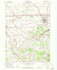
Editions of this 1960 Swanton Map
2 editions found
Other maps of this area

1908 · Napoleon
USGS Topo · 1:62,500

1909 · Mc Clure
USGS Topo · 1:62,500

1911 · Wauseon
USGS Topo · 1:62,500

1911 · Swanton
USGS Topo · 1:62,500

1913 · Wauseon
USGS Topo · 1:62,500

1914 · Swanton
USGS Topo · 1:62,500

1935 · Grand Rapids
USGS Topo · 1:24,000

1935 · Whitehouse
USGS Topo · 1:24,000

1935 · Berkey
USGS Topo · 1:24,000

1939 · Berkey
USGS Topo · 1:31,680