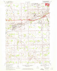
1969 Map of Swartz Creek
USGS Topo · Published 1971About this map
The city of Swartz Creek serves as the focal point of this late-1960s survey, showing a landscape in transition as residential subdivisions and public institutions expand around the Grand Trunk Western railroad corridor. The area's educational infrastructure is well-documented, featuring schools like St Marys Sch, Jr High Sch, and Crocker Sch, alongside suburban developments such as the Oakwood Golf Course and a large Shopping Center near the Bishop Airport boundary.
Find a feature on this map
61 named features on this map. Tap any name to fly to it.
Don’t see what you’re looking for? This feature index may not catch every label — zoom into the map to look around manually.
Map Details
Editions of this 1969 Swartz Creek Map
2 editions found
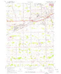
Other maps of this area

1919 · Burt
USGS Topo · 1:62,500

1920 · Flint
USGS Topo · 1:62,500

1920 · Holly
USGS Topo · 1:62,500

1921 · Burt
USGS Topo · 1:62,500

1922 · Holly
USGS Topo · 1:62,500

1922 · Durand
USGS Topo · 1:62,500

1922 · Flint
USGS Topo · 1:62,500

1943 · Holly
USGS Topo · 1:62,500

1943 · Burt
USGS Topo · 1:62,500

1943 · Durand
USGS Topo · 1:62,500
Featured Places
- Flint, MI
- Swartz Creek, MI
- Flint Charter Township, MI
- Clayton Charter Township, MI
- Mundy Charter Township, MI