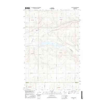
2017 Map of Sylvan Lake
USGS Topo · Published 2017About this map
Nemo sits in the northwest corner of this eastern Washington landscape, positioned along the banks of Coal Cr as it flows toward the expansive Sylvan Lake. The terrain is characterized by a series of coulees and seasonal watercourses, including Crab Cr, which drains the southern portion of the quadrangle. This 2017 survey reveals a rural landscape structured by an extensive grid of local roads, many bearing the names of established ranching and farming families such as Laney Brothers Rd E, King Ranch Rd E, and Heimbigner Rd E.
Find a feature on this map
31 named features on this map. Tap any name to fly to it.
Don’t see what you’re looking for? This feature index may not catch every label — zoom into the map to look around manually.
Map Details
Editions of this 2017 Sylvan Lake Map
This is the sole edition of this map. No revisions or reprints were ever made.
Other maps of this area

1953 · Ritzville
USGS Topo · 1:250,000

1959 · Ritzville
USGS Topo · 1:250,000

1965 · Ritzville
USGS Topo · 1:250,000

1967 · Schoonover
USGS Topo · 1:24,000

1967 · Reiman
USGS Topo · 1:24,000

1967 · Ritzville NW
USGS Topo · 1:24,000

1968 · Sylvan Lake
USGS Topo · 1:24,000

1968 · Coffeepot Lake
USGS Topo · 1:24,000

1968 · Pacific Lake
USGS Topo · 1:24,000
1968 · Odessa
USGS Topo · 1:24,000