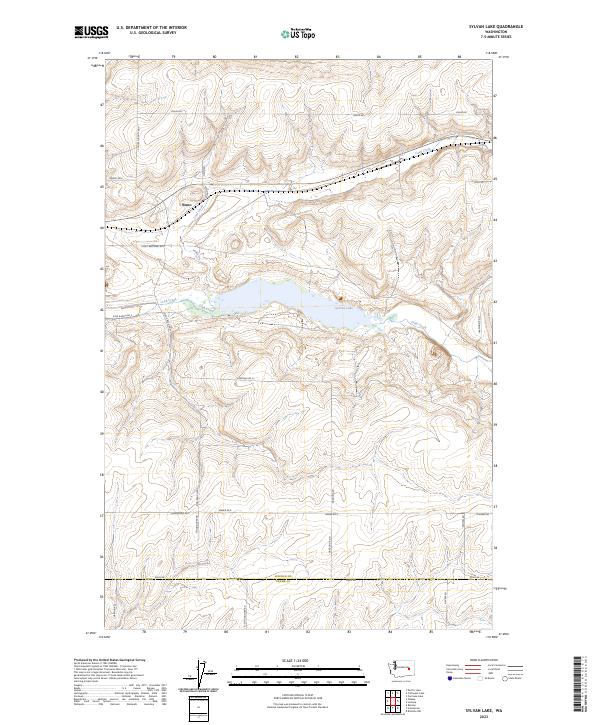
2023 Map of Sylvan Lake
USGS Topo · Published 2023About this map
Sylvan Lake and its surrounding drainage systems dominate this corner of the Columbia Plateau, where the perennial waters of Crab Creek flow through the arid landscape. The small settlement of Nemo sits in the northern reaches, connected to the wider region by a network of family-named ranch roads that underscore the area's agricultural roots. The terrain is defined by the sharp transition between elevated plateaus and the deep coulees carved by ancient floods, now occupied by intermittent streams like Coal Creek.
Find a feature on this map
31 named features on this map. Tap any name to fly to it.
Don’t see what you’re looking for? This feature index may not catch every label — zoom into the map to look around manually.
Map Details
Editions of this 2023 Sylvan Lake Map
This is the sole edition of this map. No revisions or reprints were ever made.
Other maps of this area

1953 · Ritzville
USGS Topo · 1:250,000

1959 · Ritzville
USGS Topo · 1:250,000

1965 · Ritzville
USGS Topo · 1:250,000

1967 · Schoonover
USGS Topo · 1:24,000

1967 · Reiman
USGS Topo · 1:24,000

1967 · Ritzville NW
USGS Topo · 1:24,000

1968 · Sylvan Lake
USGS Topo · 1:24,000

1968 · Coffeepot Lake
USGS Topo · 1:24,000

1968 · Pacific Lake
USGS Topo · 1:24,000
1968 · Odessa
USGS Topo · 1:24,000