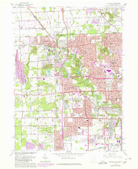
1965 Map of Sylvania
USGS Topo · Published 1980About this map
The border between Michigan and Ohio defines the northern edge of this suburban landscape, where the growing community of Sylvania meets the outskirts of Toledo. Surveyed originally in 1934 and updated with 1977 aerial photography, the map reveals a dense network of educational and religious institutions, including Lourdes Jr College and the Stranahan Sch. The terrain is shaped by the winding courses of Tenmile Creek and the Ottawa River, which flow through residential developments and established green spaces like Ottawa Hills and Camp Miakonda. Large tracts are dedicated to commemorative space, most notably the expansive Toledo Memorial Park (Cemetery). While industrial presence is noted by a Quarry and Sandpit, the area's mid-century character is largely defined by its schools and recreational facilities, such as the Toledo Suburban Airport.
Find a feature on this map
45 named features on this map. Tap any name to fly to it.
Don’t see what you’re looking for? This feature index may not catch every label — zoom into the map to look around manually.
Map Details
Editions of this 1965 Sylvania Map
Other maps of this area

1900 · Toledo
USGS Topo · 1:62,500

1911 · Swanton
USGS Topo · 1:62,500

1912 · Dundee
USGS Topo · 1:62,500

1914 · Swanton
USGS Topo · 1:62,500

1926 · Dundee
USGS Topo · 1:62,500

1934 · Rossford
USGS Topo · 1:24,000

1935 · Whitehouse
USGS Topo · 1:24,000

1935 · Maumee
USGS Topo · 1:24,000

1935 · Berkey
USGS Topo · 1:24,000

1936 · Samaria
USGS Topo · 1:31,680