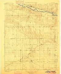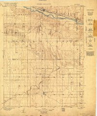
1900 Map of Syracuse
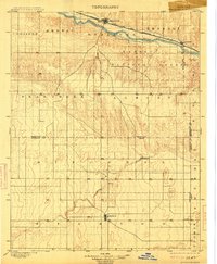
USGS Topo · Published 1913About this map
The Atchison Topeka and Santa Fe RR corridors parallel the Arkansas River across the northern edge of this high plains landscape, anchoring the early growth of Syracuse and Kendall. This 1898 survey captures the region during a pivotal period of land management, notably featuring the Kansas National Forest, an experimental timber reserve in the sand hills south of the river. Away from the rail line, the map reveals a sparse network of early Hamilton and Stanton County outposts, including Edwin, Hatton, and the settlement of Johnson. The topography is defined by the winding course of Bear Creek, which cuts through the southern townships near Gognac. This sheet provides an essential record of Western Kansas before modern irrigation and highway systems, documenting the original township divisions of Medway, Lamont, and Mitchell during the era of frontier ranching and dry-land settlement.
Find a feature on this map
24 named features on this map. Tap any name to fly to it.
Don’t see what you’re looking for? This feature index may not catch every label — zoom into the map to look around manually.
Map Details
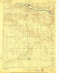
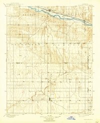
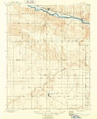
Editions of this 1900 Syracuse Map
5 editions found