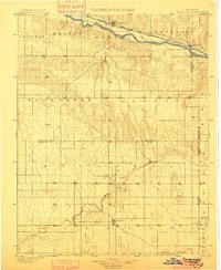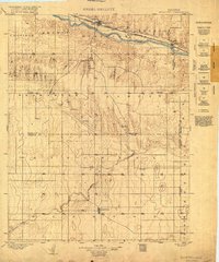
1900 Map of Syracuse
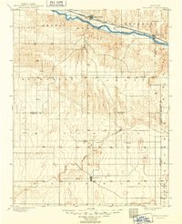
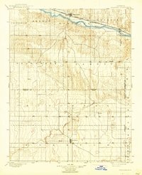
USGS Topo · Published 1938About this map
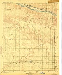
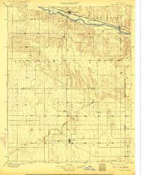
The Arkansas River corridor defines the northern settlement patterns of this western Kansas landscape, where the Atchison Topeka and Santa Fe railroad runs parallel to the water through Syracuse and Kendall. The map reveals a frontier environment undergoing early organization, shown through the emerging townships of Coolidge, Medway, and Bear Creek. While the northern rail corridor supported established hubs like Mayline and Syracuse, the southern half of the quadrangle shows a more dispersed agricultural network around Johnson and small outposts such as Floto. and Edwin. This survey, conducted by Nat. Tyler Jr. under the direction of Jno. H. Renshawe, captures the region before extensive modern development, documenting the early irrigation and transportation routes that shaped Hamilton and Stanton counties.
Find a feature on this map
28 named features on this map. Tap any name to fly to it.
Don’t see what you’re looking for? This feature index may not catch every label — zoom into the map to look around manually.
Map Details
Editions of this 1900 Syracuse Map
5 editions found