Loading...
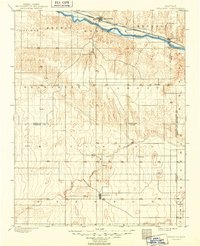
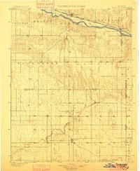
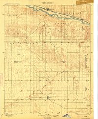
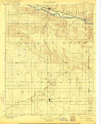
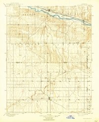
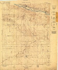
Loading map...1900 Map of Syracuse
USGS Topo · Published 1949About this map
The Arkansas River corridor serves as the primary artery of development in this western Kansas landscape surveyed at the turn of the century. The Atchison Topeka and Santa Fe railroad parallels the river, anchoring key settlements like Syracuse, Mayline, and Kendall. This infrastructure highlights the transition from river-dependent movement to the iron-rail economy that defined the region’s growth during the late nineteenth century.
Find a feature on this map
29 named features on this map. Tap any name to fly to it.
Don’t see what you’re looking for? This feature index may not catch every label — zoom into the map to look around manually.
Map Details
Date Portrayed1900
Date Published1949
PublisherU.S. Geological Survey
Map TypeTopographic
Scale1:125,000
Physical Dimensions16.3 x 20.01 inches
Editions of this 1900 Syracuse Map
5 editions found
Historical Maps of Syracuse Through Time
Featured Locations
Source Details
SourceU.S. Geological Survey
CopyrightPublic Domain