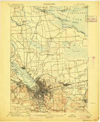
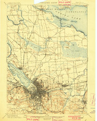
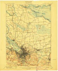
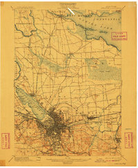
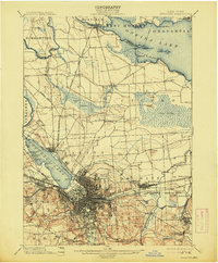
1898 Map of Syracuse
USGS Topo · Published 1905About this map
Industrial Syracuse and its surrounding canal-town landscapes are captured here during a period of significant late-Victorian expansion. The city's economic identity is tied directly to its geography, evidenced by the extensive Salt Sheds and the proximity of the Erie Canal and Oswego Canal junction. Along the southern shore of Onondaga Lake, leisure and industry collide at the Iron Pier and the State Fair Grounds, while the city's residential growth is bounded by significant burial grounds like Oakwood Cemetery and Woodlawn Cemetery.
Find a feature on this map
95 named features on this map. Tap any name to fly to it.
Don’t see what you’re looking for? This feature index may not catch every label — zoom into the map to look around manually.
Map Details
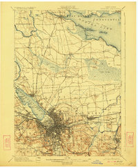
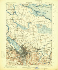
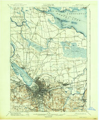
Editions of this 1898 Syracuse Map
10 editions found

1898 edition
16.6 x 20.2 inches
1901 edition
15.5 x 19.4 inches
1905 edition
16.6 x 20.1 inches
1907 edition
16.6 x 20.2 inches

1908 edition
15.64 x 19.71 inches
1910 edition
16.6 x 20.1 inches
1913 edition
16.6 x 20.1 inches
1923 edition
16.6 x 20.2 inches
1930 edition
16.4 x 19.9 inches
1937 edition
16.6 x 20.1 inches
Other maps of this area

1895 · Chittenango
USGS Topo · 1:62,500

1895 · Syracuse
USGS Topo · 1:62,500

1897 · Cazenovia
USGS Topo · 1:62,500
1898 · Syracuse
USGS Topo · 1:62,500

1898 · Chittenango
USGS Topo · 1:62,500

1899 · Skaneateles
USGS Topo · 1:62,500

1899 · Cazenovia
USGS Topo · 1:62,500

1900 · Baldwinsville
USGS Topo · 1:62,500

1900 · Tully
USGS Topo · 1:62,500

1900 · Fulton
USGS Topo · 1:62,500