
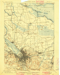
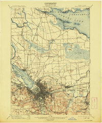
1898 Map of Syracuse
USGS Topo · Published 1908About this map
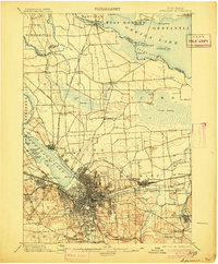
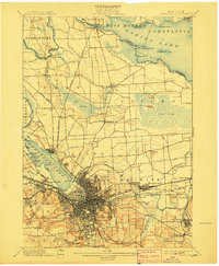
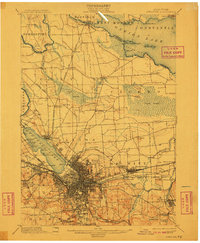
Syracuse sits at the heart of a dense industrial and transit hub during the late nineteenth century, defined by the convergence of the Erie Canal and the Oswego Canal. The city's landscape is heavily influenced by its manufacturing identity, particularly evident in the extensive Salt Sheds near the shores of Onondaga Lake and the specialized Solvay Process Co's R. R. serving the nearby industrial works. To the north, the terrain transitions into the sprawling Cicero Swamp, while the southern hills are marked by prominent burial grounds like Oakwood Cemetery and St. Agnes Cemetery. This survey captures the region just before the widespread modernization of the canal systems, showing the intricate web of competing rail lines like the Central and Hudson River R. R. and the West Shore R. R. that fueled the area's growth.
Find a feature on this map
99 named features on this map. Tap any name to fly to it.
Don’t see what you’re looking for? This feature index may not catch every label — zoom into the map to look around manually.
Map Details
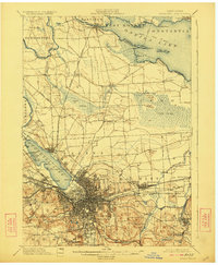
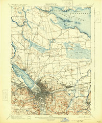
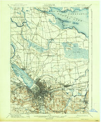
Editions of this 1898 Syracuse Map
10 editions found

1898 edition
16.6 x 20.2 inches
1901 edition
15.5 x 19.4 inches
1905 edition
16.6 x 20.1 inches
1907 edition
16.6 x 20.2 inches
1908 edition
15.64 x 19.71 inches
1910 edition
16.6 x 20.1 inches
1913 edition
16.6 x 20.1 inches
1923 edition
16.6 x 20.2 inches
1930 edition
16.4 x 19.9 inches
1937 edition
16.6 x 20.1 inches
Other maps of this area

1895 · Chittenango
USGS Topo · 1:62,500

1895 · Syracuse
USGS Topo · 1:62,500

1897 · Cazenovia
USGS Topo · 1:62,500
1898 · Syracuse
USGS Topo · 1:62,500

1898 · Chittenango
USGS Topo · 1:62,500

1899 · Skaneateles
USGS Topo · 1:62,500

1899 · Cazenovia
USGS Topo · 1:62,500

1900 · Baldwinsville
USGS Topo · 1:62,500

1900 · Tully
USGS Topo · 1:62,500

1900 · Fulton
USGS Topo · 1:62,500