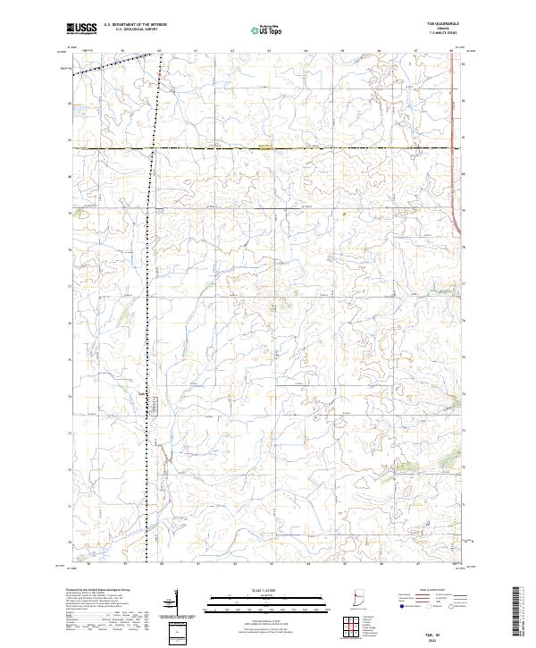
2022 Map of Tab
USGS Topo · Published 2022About this map
The unincorporated community of Tab anchors this agricultural landscape at the western edge of the Indiana prairie. Situated in Warren County, this area is defined by the strict geometry of the Public Land Survey System, with roads following section lines across several townships including t23n r9w and t24n r9w. The land's natural drainage is reflected in the winding paths of Goose Cr and the engineered channel of Farrell Ditch, which support the intensive farming characteristic of the region. The map captures the quiet persistence of these small rural crossroads in the early 21st century, where local life is still governed by the township and range grid established centuries prior.
Find a feature on this map
13 named features on this map. Tap any name to fly to it.
Don’t see what you’re looking for? This feature index may not catch every label — zoom into the map to look around manually.
Map Details
Editions of this 2022 Tab Map
This is the sole edition of this map. No revisions or reprints were ever made.
Other maps of this area

1933 · Hoopeston
USGS Topo · 1:48,000

1938 · Milford
USGS Topo · 1:48,000

1938 · Hoopeston
USGS Topo · 1:62,500

1944 · Milford
USGS Topo · 1:62,500

1953 · Danville
USGS Topo · 1:250,000

1955 · Danville
USGS Topo · 1:250,000

1956 · Danville
USGS Topo · 1:250,000

1961 · Tab
USGS Topo · 1:24,000

1961 · Pine Village
USGS Topo · 1:24,000

1961 · West Lebanon
USGS Topo · 1:24,000