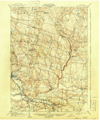
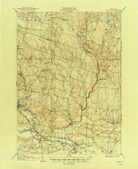
1905 Map of Taberg
USGS Topo · Published 1942About this map
The East Branch Fish River and West Branch Fish River converge south of Camden, carving a landscape of timber and early water power at the turn of the century. This survey, conducted by H.M. Wilson and J.H. Jennings, captures the region's transition from a logging and milling economy to an established railway corridor. Industrial artifacts of the era are visible in the northern hills, where Leisher Mill and Swancott Mill sit near the Lewis and Oneida County line. The rail network is well-developed, featuring the New York Central and Hudson River RR and the Oswego and Rome Line, which serviced rural junctions like Mc Connellsville and Blosvale. Settlements such as Empeyville and Lee Center dot the landscape, illustrating the dense network of post offices and small crossroads that defined Oneida County's rural character before the mid-century.
Find a feature on this map
52 named features on this map. Tap any name to fly to it.
Don’t see what you’re looking for? This feature index may not catch every label — zoom into the map to look around manually.
Map Details
Editions of this 1905 Taberg Map
6 editions found

Other maps of this area

1895 · Chittenango
USGS Topo · 1:62,500

1895 · Oriskany
USGS Topo · 1:62,500

1895 · Oneida
USGS Topo · 1:62,500

1898 · Oneida
USGS Topo · 1:62,500

1898 · Chittenango
USGS Topo · 1:62,500

1898 · Oriskany
USGS Topo · 1:62,500

1902 · Chittenango
USGS Topo · 1:62,500

1902 · Oneida
USGS Topo · 1:62,500

1903 · Orwell
USGS Topo · 1:62,500

1904 · Boonville
USGS Topo · 1:62,500