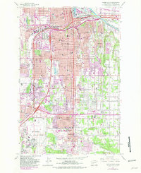
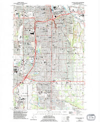
1961 Map of Tacoma South
USGS Topo · Published 1981About this map
The Puyallup River flows through the northeastern corner of this area, marking the industrial and residential transition of South Tacoma during the mid-twentieth century. The landscape is a mix of dense residential grids and significant institutional footprints, including the sprawling campus of Pacific Lutheran University in Parkland and the massive grounds of Mc Chord Air Force Base to the south. The expansion of suburban retail is evident at the Tacoma Mall Shopping Center, while traditional community landmarks like Lincoln High Sch and Holy Rosary Sch anchor the older neighborhoods. This survey captures a moment when established rail lines, such as the Union Pacific and Burlington Northern, shared space with a rapidly developing network of major arterials including Pacific Ave and Portland Ave, illustrating the region's evolution from a rail-dependent hub to a highway-centered urban corridor.
Find a feature on this map
88 named features on this map. Tap any name to fly to it.
Don’t see what you’re looking for? This feature index may not catch every label — zoom into the map to look around manually.
Map Details
Editions of this 1961 Tacoma South Map
5 editions found
Other maps of this area

1897 · Tacoma
USGS Topo · 1:125,000

1900 · Tacoma
USGS Topo · 1:125,000

1940 · Anderson Island
USGS Topo · 1:62,500

1941 · Tacoma South
USGS Topo · 1:62,500

1942 · Gig Harbor
USGS Topo · 1:62,500

1943 · Gig Harbor
USGS Topo · 1:62,500

1944 · Tacoma South
USGS Topo · 1:62,500

1948 · Anderson Island
USGS Topo · 1:62,500

1948 · Fort Lewis
USGS Topo · 1:24,000

1948 · Steilacoom
USGS Topo · 1:24,000