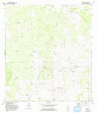
1972 Map of Tacubaya
USGS Topo · Published 1993About this map
Tacubaya and its surrounding ranchlands reveal a landscape shaped by the hunt for water and oil in the early 1970s. The region is dotted with numerous family-named landmarks and infrastructure, from the Mala Suerte Windmill to the Leon Cito Windmill, illustrating the vital importance of groundwater in this part of South Texas. Settled outposts like Alta Mesa Camp and the Alto Colorado Ranch are connected by a network of unimproved roads and a dedicated Landing Strip, supporting both cattle operations and the industrial presence of the Alta Mesa Oil Field.
Find a feature on this map
38 named features on this map. Tap any name to fly to it.
Don’t see what you’re looking for? This feature index may not catch every label — zoom into the map to look around manually.
Map Details
Editions of this 1972 Tacubaya Map
2 editions found
Other maps of this area

1921 · Falfurrias
USGS Topo · 1:125,000

1939 · Encantada
USGS Topo · 1:62,500

1949 · Mc Allen
USGS Topo · 1:250,000

1954 · McAllen
USGS Topo · 1:250,000

1956 · Laredo
USGS Topo · 1:250,000

1957 · Mc Allen
USGS Topo · 1:250,000

1962 · McAllen
USGS Topo · 1:250,000

1963 · Cage Ranch
USGS Topo · 1:24,000
1963 · Encino
USGS Topo · 1:24,000
1963 · Hartland
USGS Topo · 1:24,000