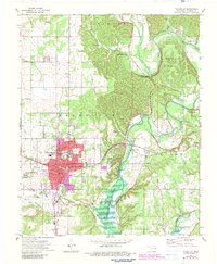
1972 Map of Tahlequah
USGS Topo · Published 1983About this map
Tahlequah serves as the focal point of this 1970s survey, showing the town's expansion and the prominent campus of Northeastern State College. The landscape is defined by the winding course of the Illinois River and its transition into Lake Tenkiller at the southern edge. Local history is deeply etched into the terrain through family and community landmarks like Manus Cem and the Indian Campground Cem, alongside various educational institutions such as Sequoyah Sch and the Markoma Bible Academy.
Find a feature on this map
54 named features on this map. Tap any name to fly to it.
Don’t see what you’re looking for? This feature index may not catch every label — zoom into the map to look around manually.
Map Details
Editions of this 1972 Tahlequah Map
3 editions found
Other maps of this area

1896 · Pryor
USGS Topo · 1:125,000

1898 · Tahlequah
USGS Topo · 1:125,000

1899 · Siloam Springs
USGS Topo · 1:125,000

1901 · Muscogee
USGS Topo · 1:125,000

1901 · Pryor
USGS Topo · 1:125,000

1901 · Tahlequah
USGS Topo · 1:125,000

1903 · Siloam Springs
USGS Topo · 1:125,000

1904 · Siloam Springs
USGS Topo · 1:125,000

1905 · Muscogee
USGS Topo · 1:125,000

1905 · Tahlequah
USGS Topo · 1:125,000