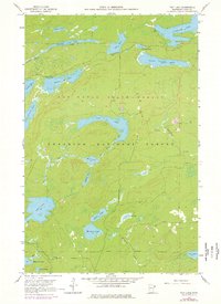
1960 Map of Tait Lake
USGS Topo · Published 1978About this map
Pat Bayle State Forest and Superior National Forest define the wild character of this Cook County landscape, where an intricate network of glacial lakes and river systems dominates the terrain. This 1960 survey, updated with 1976 revisions, shows the area as it appeared before heavy modern development, highlighting the central basin of Tait Lake and the winding course of the Tait River. The map reveals a remote geography shaped by water, from the larger Cascade Lake and Lake Clara to smaller, family-named or descriptive bodies like Mistletoe Lake, Lichen Lake, and Roast Lake. While the land is primarily managed for timber and conservation, the presence of a Campground and various Gravel Pit locations indicates the modest human footprint of logging and recreation during the mid-20th century. Topographic details, including depth curves for the major lakes, provide a rare look at the underwater contours of the North Shore hinterlands.
Find a feature on this map
29 named features on this map. Tap any name to fly to it.
Don’t see what you’re looking for? This feature index may not catch every label — zoom into the map to look around manually.
Map Details
Editions of this 1960 Tait Lake Map
5 editions found
Other maps of this area

1919 · Brule Lake
USGS Topo · 1:62,500

1919 · Lutsen
USGS Topo · 1:62,500

1954 · Two Harbors
USGS Topo · 1:250,000

1955 · Tofte
USGS Topo · 1:62,500

1957 · Two Harbors
USGS Topo · 1:250,000

1958 · Two Harbors
USGS Topo · 1:250,000

1958 · Deer Yard Lake
USGS Topo · 1:24,000

1959 · Lutsen
USGS Topo · 1:24,000

1960 · Tait Lake
USGS Topo · 1:24,000

1960 · Mark Lake
USGS Topo · 1:24,000