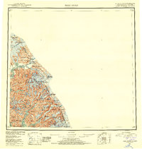
1953 Map of Taku River
USGS Topo · Published 1953About this map
The Taku River corridor serves as the primary artery through this glaciated landscape, where the international boundary between Alaska and British Columbia is defined by a series of high mountain peaks. The presence of U S Customs and the Taku Lodge near the riverbanks highlights the historical importance of this waterway as a transboundary transit point. Toward the southern end of the sheet, Port Snettisham opens into the larger Stephens Passage, while the Speel River and Whiting River drain the icefields of the Tongass National Forest. Evidence of early industrial activity appears near the coast at the Whiggy Mine, located south of Mallard Cove. The terrain is characterized by massive ice features like Twin Glaciers and the Wright Glacier, alongside numerous named summits such as Devils Paw and Mt Ogden that once served as critical markers for the International Boundary Commission.
Find a feature on this map
73 named features on this map. Tap any name to fly to it.
Don’t see what you’re looking for? This feature index may not catch every label — zoom into the map to look around manually.
Map Details
Editions of this 1953 Taku River Map
4 editions found

Other maps of this area

1948 · Sitka D-1
USGS Topo · 1:63,360

1948 · Sumdum D-6
USGS Topo · 1:63,360

1948 · Sumdum D-5
USGS Topo · 1:63,360

1948 · Juneau B-1
USGS Topo · 1:63,360

1949 · Atlin
USGS Topo · 1:250,000

1951 · Juneau
USGS Topo · 1:250,000

1951 · Atlin
USGS Topo · 1:250,000

1951 · Taku River A-4
USGS Topo · 1:63,360

1951 · Taku River B-6
USGS Topo · 1:63,360

1951 · Taku River A-5
USGS Topo · 1:63,360