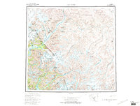
1960 Map of Taku River
USGS Topo · Published 1971About this map
Taku River serves as the central artery for this cross-border survey, flowing from its headwaters in the Taku Plateau toward the Taku Inlet near the City and Borough of Juneau. The landscape is dominated by the massive ice fields of the Coast Mountains, where Taku Glacier, Wright Glacier, and the Hole-in-the-Wall Glacier carve through the terrain. Human presence is concentrated at small outposts such as Taku Lodge and the remote settlement of Tulsequah near the United States-Canada border.
Find a feature on this map
54 named features on this map. Tap any name to fly to it.
Don’t see what you’re looking for? This feature index may not catch every label — zoom into the map to look around manually.
Map Details
Editions of this 1960 Taku River Map
4 editions found

Other maps of this area

1948 · Sitka D-1
USGS Topo · 1:63,360

1948 · Sumdum D-6
USGS Topo · 1:63,360

1948 · Sumdum D-5
USGS Topo · 1:63,360

1948 · Juneau B-1
USGS Topo · 1:63,360

1949 · Atlin
USGS Topo · 1:250,000

1951 · Juneau
USGS Topo · 1:250,000

1951 · Atlin
USGS Topo · 1:250,000

1951 · Taku River A-4
USGS Topo · 1:63,360

1951 · Taku River B-6
USGS Topo · 1:63,360

1951 · Taku River A-5
USGS Topo · 1:63,360