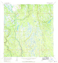
1954 Map of Talkeetna A-2
USGS Topo · Published 1970About this map
The Kahiltna River snakes through this 1950s interior landscape, defining a complex network of wetlands and tributaries before the modern development of the Susitna Valley. The map captures a largely untouched wilderness where human presence is limited to isolated structures, such as the Cabins on the western shore of Shulin Lake. This area is characterized by a high density of water bodies, including Schnieder Lake and Amber Lake, set amidst the drainage basins of Peters Creek and Kroto Creek. The presence of numerous unnamed lakes and the serpentine path of Treasure Creek in the northwest reflect a terrain dictated by glacial history and seasonal water flow. This survey provides a baseline of the regional hydrology and early settlements in the Matanuska-Susitna area during the mid-century period.
Find a feature on this map
11 named features on this map. Tap any name to fly to it.
Don’t see what you’re looking for? This feature index may not catch every label — zoom into the map to look around manually.
Map Details
Editions of this 1954 Talkeetna A-2 Map
3 editions found
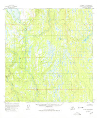
Other maps of this area

1949 · Tyonek
USGS Topo · 1:250,000

1950 · Talkeetna
USGS Topo · 1:250,000

1951 · Talkeetna
USGS Topo · 1:250,000

1951 · Talkeetna B-1
USGS Topo · 1:63,360

1951 · Tyonek
USGS Topo · 1:250,000

1952 · Talkeetna A-1
USGS Topo · 1:63,360

1954 · Tyonek D-2
USGS Topo · 1:63,360

1954 · Tyonek D-3
USGS Topo · 1:63,360

1954 · Talkeetna A-3
USGS Topo · 1:63,360

1954 · Talkeetna A-2
USGS Topo · 1:63,360