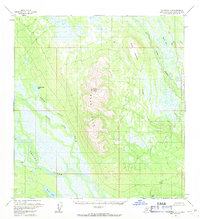
1954 Map of Talkeetna A-3
USGS Topo · Published 1971About this map
The Yenlo Hills dominate this portion of the Matanuska-Susitna region, rising sharply above a landscape defined by complex water systems and wetlands in the mid-1950s. Mount Yenlo stands as the primary landmark of this central ridge, which separates the drainage of Lake Creek to the east from the Yentna River basin to the southwest. The presence of isolated cabins near the riverbanks and lakes suggests a reliance on the area's natural resources for subsistence or seasonal use during this era. Extensive wet areas and swamps surround prominent bodies of water like Donkey Creek Lake and Shovel Lake, illustrating the difficult terrain that historically limited overland transport. The reliance on river corridors like the Donkey Creek and its associated slough reflects a time when water remained the primary artery for movement through the Alaskan interior.
Find a feature on this map
15 named features on this map. Tap any name to fly to it.
Don’t see what you’re looking for? This feature index may not catch every label — zoom into the map to look around manually.
Map Details
Editions of this 1954 Talkeetna A-3 Map
3 editions found
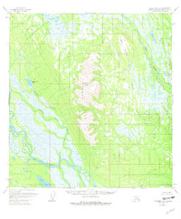
Other maps of this area

1949 · Tyonek
USGS Topo · 1:250,000

1950 · Talkeetna
USGS Topo · 1:250,000

1951 · Talkeetna
USGS Topo · 1:250,000

1951 · Tyonek
USGS Topo · 1:250,000

1954 · Tyonek D-3
USGS Topo · 1:63,360

1954 · Talkeetna A-3
USGS Topo · 1:63,360

1954 · Tyonek D-5
USGS Topo · 1:63,360

1954 · Tyonek D-4
USGS Topo · 1:63,360

1954 · Talkeetna B-4
USGS Topo · 1:63,360

1954 · Talkeetna A-2
USGS Topo · 1:63,360