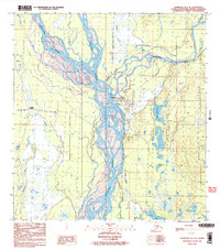
1987 Map of Talkeetna B-1 SE
USGS Topo · Published 1987About this map
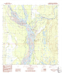
Talkeetna serves as the focal point of this late-twentieth-century landscape, positioned at the critical confluence where the Chulitna River, Talkeetna River, and Susitna River converge. The intricate braided river systems and numerous side channels, such as Billion Slough and Whiskers Slough, define the local geography and transport history. Infrastructure follows the water, with The Alaska Railroad cutting a north-south path through the valley and the Airport and Radio Towers highlighting the town's role as a regional aviation and communications hub. To the east, the terrain rises into the Bartlett Hills and the Talkeetna Lakes region, including Christiansen Lake. Local landmarks like the Cem and various Gravel Pits provide specific points of interest for genealogists and researchers looking at the development of this Matanuska-Susitna Borough community.
Find a feature on this map
24 named features on this map. Tap any name to fly to it.
Don’t see what you’re looking for? This feature index may not catch every label — zoom into the map to look around manually.
Map Details
Editions of this 1987 Talkeetna B-1 SE Map
2 editions found
Other maps of this area

1949 · Talkeetna Mountains B-6
USGS Topo · 1:63,360

1950 · Talkeetna Mountains
USGS Topo · 1:250,000

1950 · Talkeetna
USGS Topo · 1:250,000

1950 · Talkeetna Mountains A-6
USGS Topo · 1:63,360

1951 · Talkeetna
USGS Topo · 1:250,000

1951 · Talkeetna B-1
USGS Topo · 1:63,360

1952 · Talkeetna Mountains B-6
USGS Topo · 1:63,360

1952 · Talkeetna A-1
USGS Topo · 1:63,360
1952 · Talkeetna Mountains A-6
USGS Topo · 1:63,360

1954 · Talkeetna Mountains
USGS Topo · 1:250,000