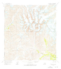
1958 Map of Talkeetna B-6
USGS Topo · Published 2000About this map
Cathedral Spires and the jagged peaks of the Kichatna Mountains dominate this glacial environment within the Matanuska-Susitna Borough. Photogrammetric methods from 1957 aerial photography revealed a complex network of ice and rock, featuring the massive Tatina Glacier and the distinctively named Cul-de-sac Glacier. This survey captures the region before extensive modern nomenclature, focusing on prominent elevations like Kichatna Spire, Gurney Peak, and Augustin Peak.
Find a feature on this map
25 named features on this map. Tap any name to fly to it.
Don’t see what you’re looking for? This feature index may not catch every label — zoom into the map to look around manually.
Map Details
Editions of this 1958 Talkeetna B-6 Map
3 editions found
Other maps of this area

1949 · McGrath
USGS Topo · 1:250,000

1950 · McGrath
USGS Topo · 1:250,000

1950 · Talkeetna
USGS Topo · 1:250,000

1951 · Talkeetna
USGS Topo · 1:250,000

1958 · Talkeetna A-6
USGS Topo · 1:63,360

1958 · Talkeetna A-5
USGS Topo · 1:63,360

1958 · Talkeetna B-5
USGS Topo · 1:63,360

1958 · Talkeetna B-6
USGS Topo · 1:63,360

1958 · Talkeetna C-6
USGS Topo · 1:63,360

1958 · McGrath B-1
USGS Topo · 1:63,360