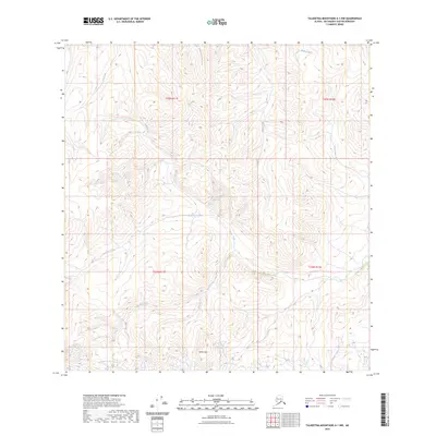
2023 Map of Talkeetna Mountains A-1 NW
USGS Topo · Published 2023About this map
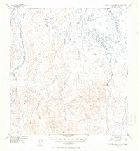
White Hill stands as a prominent elevation in this northern reach of the Matanuska-Susitna Borough, where an intricate web of drainages shapes the landscape. The hydrology of the region is defined by the significant southward flow of Tyone Creek and its diverse tributaries, including Buchia Creek and Yacko Creek. These waterways form a complex dendritic pattern through the terrain, illustrating the natural drainage systems of the Talkeetna Mountains. Further north, the headwaters of Walker Creek and Joe Creek navigate high-elevation contours, while Red Fox Creek and Red Creek cut through the western sections. This survey provides a precise look at the uninhabited backcountry of the Susitna River basin, where the absence of roads or structures highlights the wild, undeveloped nature of these Alaskan highlands.
Find a feature on this map
14 named features on this map. Tap any name to fly to it.
Don’t see what you’re looking for? This feature index may not catch every label — zoom into the map to look around manually.
Map Details
Editions of this 2023 Talkeetna Mountains A-1 NW Map
This is the sole edition of this map. No revisions or reprints were ever made.
Other maps of this area

1949 · Talkeetna Mountains A-1
USGS Topo · 1:63,360

1950 · Talkeetna Mountains
USGS Topo · 1:250,000

1951 · Talkeetna Mountains B-1
USGS Topo · 1:63,360

1951 · Talkeetna Mountains A-2
USGS Topo · 1:63,360

1951 · Talkeetna Mountains B-2
USGS Topo · 1:63,360
1952 · Talkeetna Mountains A-1
USGS Topo · 1:63,360
1952 · Talkeetna Mountains A-2
USGS Topo · 1:63,360
1952 · Talkeetna Mountains B-2
USGS Topo · 1:63,360
1952 · Talkeetna Mountains B-1
USGS Topo · 1:63,360

1954 · Talkeetna Mountains
USGS Topo · 1:250,000