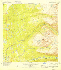
1952 Map of Talkeetna Mountains A-6
USGS Topo · Published 1952About this map
Kashwitna River and its North Fork carve through the southwestern reaches of the Talkeetna Mountains in this early post-war survey. Based on 1949 aerial photography, the map reveals a wilderness dominated by drainage patterns where the highlands meet the lower wetlands to the west. A series of surveying benchmarks, such as VABM 4150 Wolverine and VABM 4559 Snowshoe, name the high peaks that overlook the transition from alpine terrain to the lake-strewn flats.
Find a feature on this map
19 named features on this map. Tap any name to fly to it.
Don’t see what you’re looking for? This feature index may not catch every label — zoom into the map to look around manually.
Map Details
Editions of this 1952 Talkeetna Mountains A-6 Map
2 editions found
Other maps of this area

1949 · Tyonek
USGS Topo · 1:250,000

1949 · Anchorage D-7
USGS Topo · 1:63,360

1949 · Talkeetna Mountains B-6
USGS Topo · 1:63,360

1949 · Anchorage D-8
USGS Topo · 1:63,360

1950 · Talkeetna Mountains
USGS Topo · 1:250,000

1950 · Talkeetna
USGS Topo · 1:250,000

1950 · Talkeetna Mountains B-5
USGS Topo · 1:63,360

1950 · Talkeetna Mountains A-6
USGS Topo · 1:63,360

1950 · Talkeetna Mountains A-5
USGS Topo · 1:63,360

1951 · Talkeetna
USGS Topo · 1:250,000