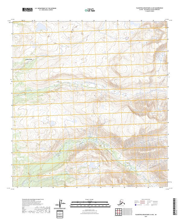
2023 Map of Talkeetna Mountains A-6 NE
USGS Topo · Published 2023About this map
Susitna North occupies the northwestern corner of this quadrangle, where the headwaters of the regional drainage systems begin their descent from the high Talkeetna terrain. The landscape is defined by a series of parallel watercourses, including the Middle Fork Montana Creek, the South Fork Montana Creek, and Sheep Creek, which carve deep valleys as they flow westward. The survey reveals a remote area largely defined by these glacial-fed streams and the expansive public land survey divisions, ranging from t25n r3w to t24n r1w. The lack of dense road infrastructure in this 2023 update highlights the preservation of the natural drainage patterns that have shaped the Matanuska-Susitna Borough for generations.
Find a feature on this map
10 named features on this map. Tap any name to fly to it.
Don’t see what you’re looking for? This feature index may not catch every label — zoom into the map to look around manually.
Map Details
Editions of this 2023 Talkeetna Mountains A-6 NE Map
This is the sole edition of this map. No revisions or reprints were ever made.
Other maps of this area

1949 · Talkeetna Mountains B-6
USGS Topo · 1:63,360

1950 · Talkeetna Mountains
USGS Topo · 1:250,000

1950 · Talkeetna Mountains B-5
USGS Topo · 1:63,360

1950 · Talkeetna Mountains A-6
USGS Topo · 1:63,360

1950 · Talkeetna Mountains A-5
USGS Topo · 1:63,360

1952 · Talkeetna Mountains B-6
USGS Topo · 1:63,360
1952 · Talkeetna Mountains B-5
USGS Topo · 1:63,360
1952 · Talkeetna Mountains A-5
USGS Topo · 1:63,360
1952 · Talkeetna Mountains A-6
USGS Topo · 1:63,360

1954 · Talkeetna Mountains
USGS Topo · 1:250,000