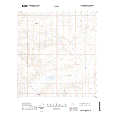
2023 Map of Talkeetna Mountains B-2 NW
USGS Topo · Published 2023About this map
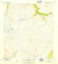
The high-altitude hydrology of the t28n r8e and t28n r9e townships is defined by the headwaters of the Black River and the isolated waters of Black Lake. This section of the Matanuska-Susitna Borough reveals a landscape shaped by drainage patterns where George Creek and Busch Creek navigate the steep contours of the Talkeetna Mountains. The most notable human footprint in this wilderness is the Busch Creek Airport, a small airstrip located in the northeast corner of the quadrangle. Its presence suggests the essential role of general aviation in accessing these high-country interior regions where roads are absent. The map detail highlights the intersection of several township boundaries, including t27n r8e and t27n r9e, illustrating how the Public Land Survey System imposes order over the complex, water-carved terrain of the Alaskan interior.
Find a feature on this map
11 named features on this map. Tap any name to fly to it.
Don’t see what you’re looking for? This feature index may not catch every label — zoom into the map to look around manually.
Map Details
Editions of this 2023 Talkeetna Mountains B-2 NW Map
This is the sole edition of this map. No revisions or reprints were ever made.
Other maps of this area

1950 · Talkeetna Mountains
USGS Topo · 1:250,000

1951 · Talkeetna Mountains C-2
USGS Topo · 1:63,360

1951 · Talkeetna Mountains B-3
USGS Topo · 1:63,360

1951 · Talkeetna Mountains B-2
USGS Topo · 1:63,360

1951 · Talkeetna Mountains C-3
USGS Topo · 1:63,360
1952 · Talkeetna Mountains C-3
USGS Topo · 1:63,360
1952 · Talkeetna Mountains B-3
USGS Topo · 1:63,360
1952 · Talkeetna Mountains B-2
USGS Topo · 1:63,360
1952 · Talkeetna Mountains C-2
USGS Topo · 1:63,360

1954 · Talkeetna Mountains
USGS Topo · 1:250,000